Almost 50% of the global original forest cover has been lost in the last 8000 years mainly due to human activities. This decline, along with ecosystem fragmentation and reduction in habitat connectivity, are considered the major drivers of global biodiversity loss. Monitoring the biological diversity of forest ecosystems is crucial to prevent any further decline and to implement effective conservation and restoration practices.
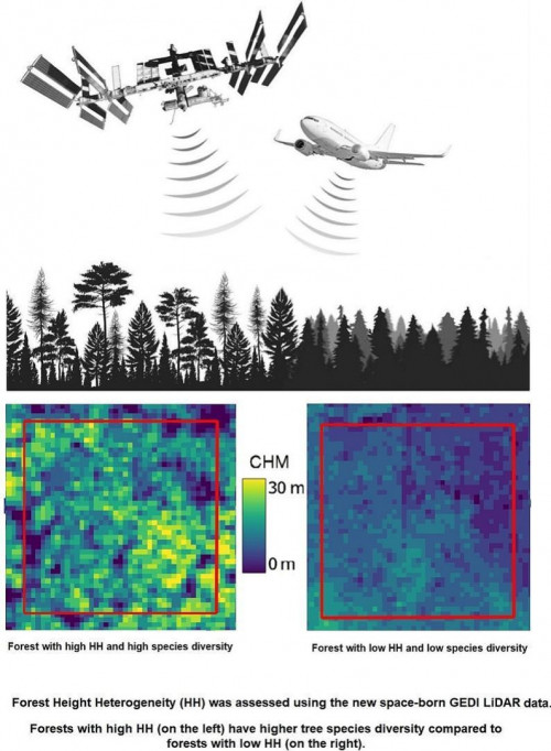
To contribute to assessing biodiversity in forest ecosystems, a new paper within SHOWCASE set out to understand if the recently published and freely available LiDAR GEDI Canopy Height Models (CHM) Lang10m and Potapov30m can be used to assess biodiversity patterns in forest ecosystems. The results suggest that GEDI LiDAR data can be a valuable tool in estimating forest tree heterogeneity and related tree species diversity, which can aid in global biodiversity estimation. However, further analysis in different forest areas using different heterogeneity indices is needed to generalise the method.
Read the full paper here.
Photo: Forest Height Heterogeneity (HH) was assessed using the new space-born GEDI LIDAR data. Forests with high HH (on the left) have higher tree species diversity compared to forests with low HH (on the right). Graphical abstract of the paper.