In recent decades, agricultural landscapes have witnessed declining plant and insect biodiversity, leading to diminished benefits for crops and humans. This decline, attributed to changes in land use, intensive agriculture, climate change, and habitat loss, affects insect niches and jeopardises insect pollinators' part in sustaining wild plant species, cultural ecosystem services, and agricultural yields. They also play a crucial economic role, contributing more than 150 billion euros each year to global food production, sustaining the health and productivity of natural and agricultural ecosystems.
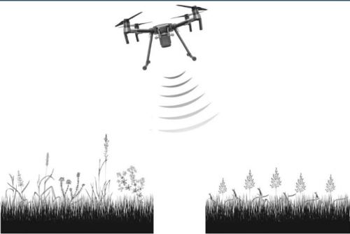
A new paper, co-funded by SHOWCASE and written by partners from Wageningen University, the University of Bologna, and the Free University of Bolzano, examines how grassland structure can aid in comprehending species distribution and abundance, by estimating flower diversity which signals bee abundance and diversity. This was done by testing a novel approach - the "Height Variation Hypothesis" (HVH), which links LiDAR data to species diversity by relating vegetation height heterogeneity (HH) to niche availability for diverse species - and combined this with operational testing using Unoccupied Aerial Vehicles (UAV). This vegetation structure is crucial, directly influencing species distribution, diversity, population dynamics, and ecological interactions, promoting species coexistence and enhancing overall biodiversity. The test was conducted in study areas located in the Southeast of the Netherlands, between Valkenburg and Gulpen, as part of the experimental biodiversity area (EBA) network.
By using this novel method, HVH, to estimate flower diversity, the research indicates that UAV-generated vegetation height heterogeneity can act as an indicator, impacting both bee diversity and abundance in grasslands.
Read the full article here.
Photo: Image from the study showing how Unoccupied Aerial Vehicles are used to test grasslands.
